Building a proof
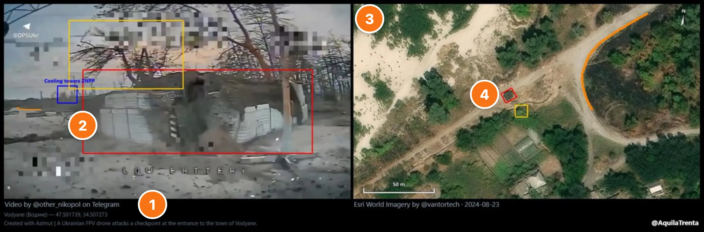
A proof is a visual argument: the source frame next to satellite imagery, with matching coloured boxes on the features that prove the match. A reader follows the boxes across both images and reaches your conclusion without taking your word for the coordinates.
- 1
Verify and archive the source
Reverse-image-search it to rule out recycled footage, then archive it. The Archived copy field under Source URL opens the Wayback Machine and takes back its snapshot, or an archive.today (any mirror) or Ghostarchive copy. - 2
Pin the visual anchors
Pick three or more fixed features (signage, road geometry, building footprints, infrastructure), never vehicles or smoke. - 3
Cross-reference on satellite imagery
In Google Earth or Sentinel Hub, match shape, scale and relative position. - 4
Annotate the match
Box each anchor on both images, one colour per feature. - 5
Check the time of day
Match shadow direction and length to the timestamp (SunCalc). - 6
Optional: aerial footage
Match a drone or FPV clip's camera path and terrain.